Day 1: Shira Gate to Simba Camp
Elevation: 11,800 ft to 11,800 ft
Distance: 4 km | 2 miles
Hiking Time: 1-2 hours Habitat: Heath
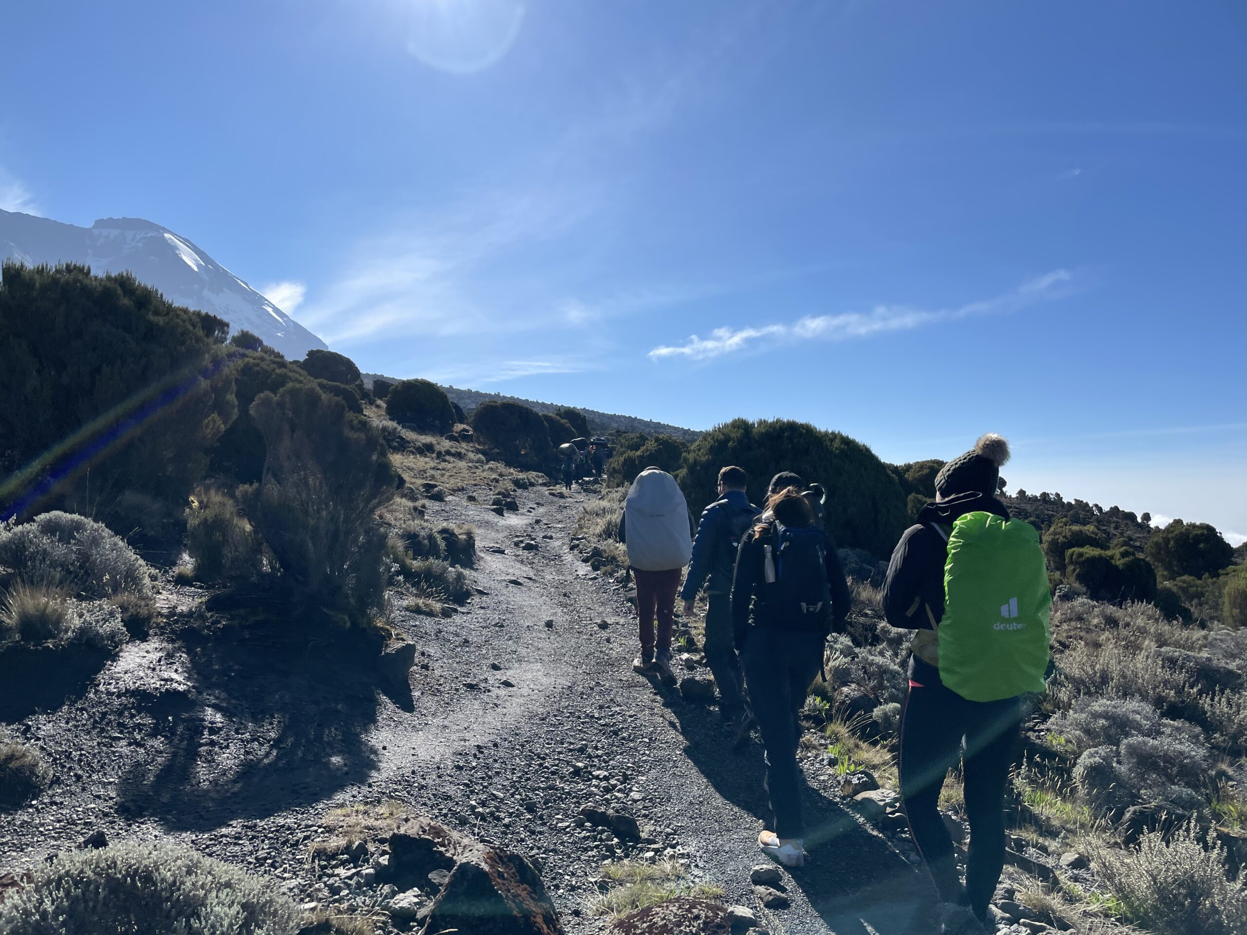
Depart in morning from the lodge to Londorossi Gate. The drive will take aprox 4 hours; once you reached the gate will come out in the vehicle to completely entry formalities, after finalizing you will continue to drive up the Shira Gate where you will start the hike. To reach Simba Camp (first point of the day) you will trek through shrubs and giant heather.
Day 2: Simba Camp to Shira 2 Camp
Elevation: 11,800 ft to 12,500 ft
Distance: 6 km | 4 miles
Hiking Time: 2 hours Habitat: Heath
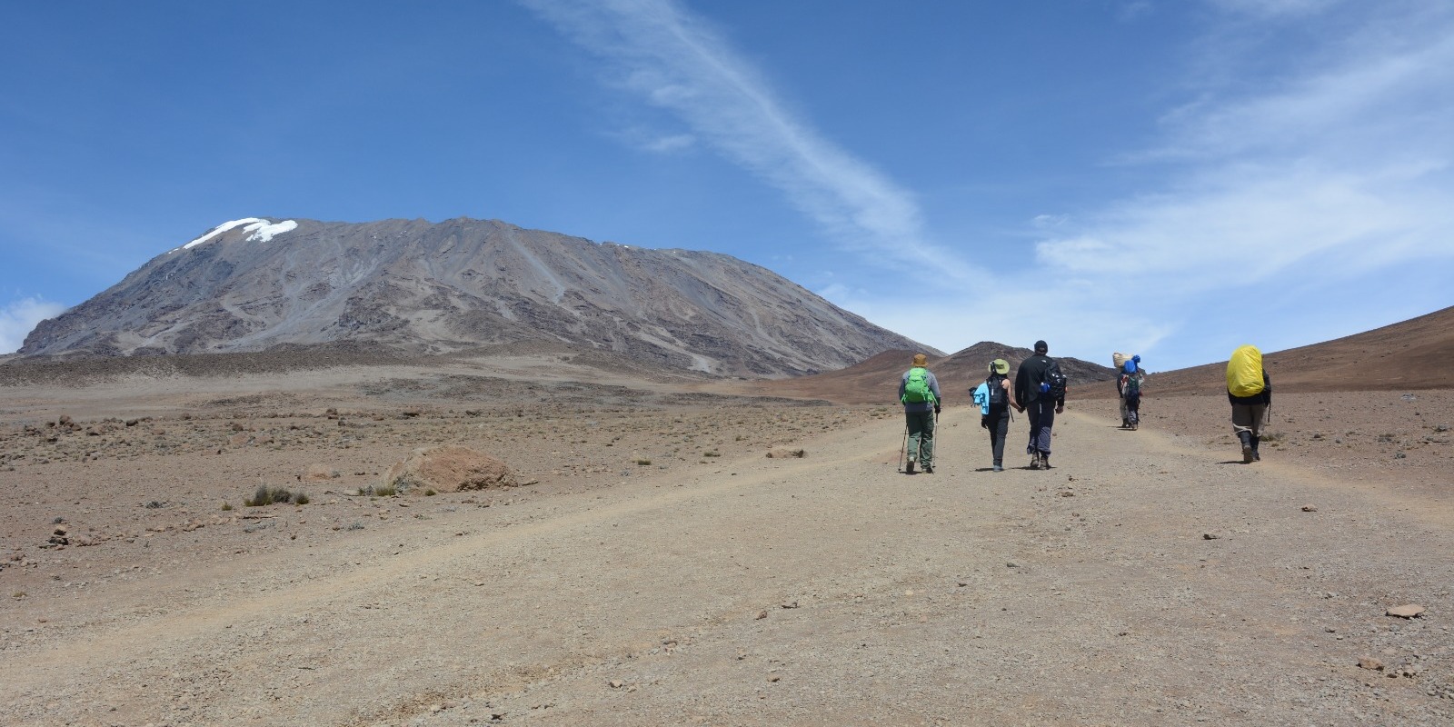
Today will be a day that will help you with acclimatization of the area. We will start by discovering the grassy moorland and volcanic rock formation on the plateau. You will take scenic route to The Shira Cathedral. You will also cross a huge buttress of rock, before reaching Shira 2 camp.
Day 3: Shira 2 Camp to Lava Tower
Elevation: 12,500 ft to 15,190 ft
Distance: 7 km | 4 miles
Hiking Time: 4-5 hours Habitat: Alpine Desert
Lava Tower to Barranco Camp
Elevation: 15,190 ft to 13,044 ft Distance: 3 km | 2 miles
Hiking Time: 2-3 hours Habitat: Alpine Desert
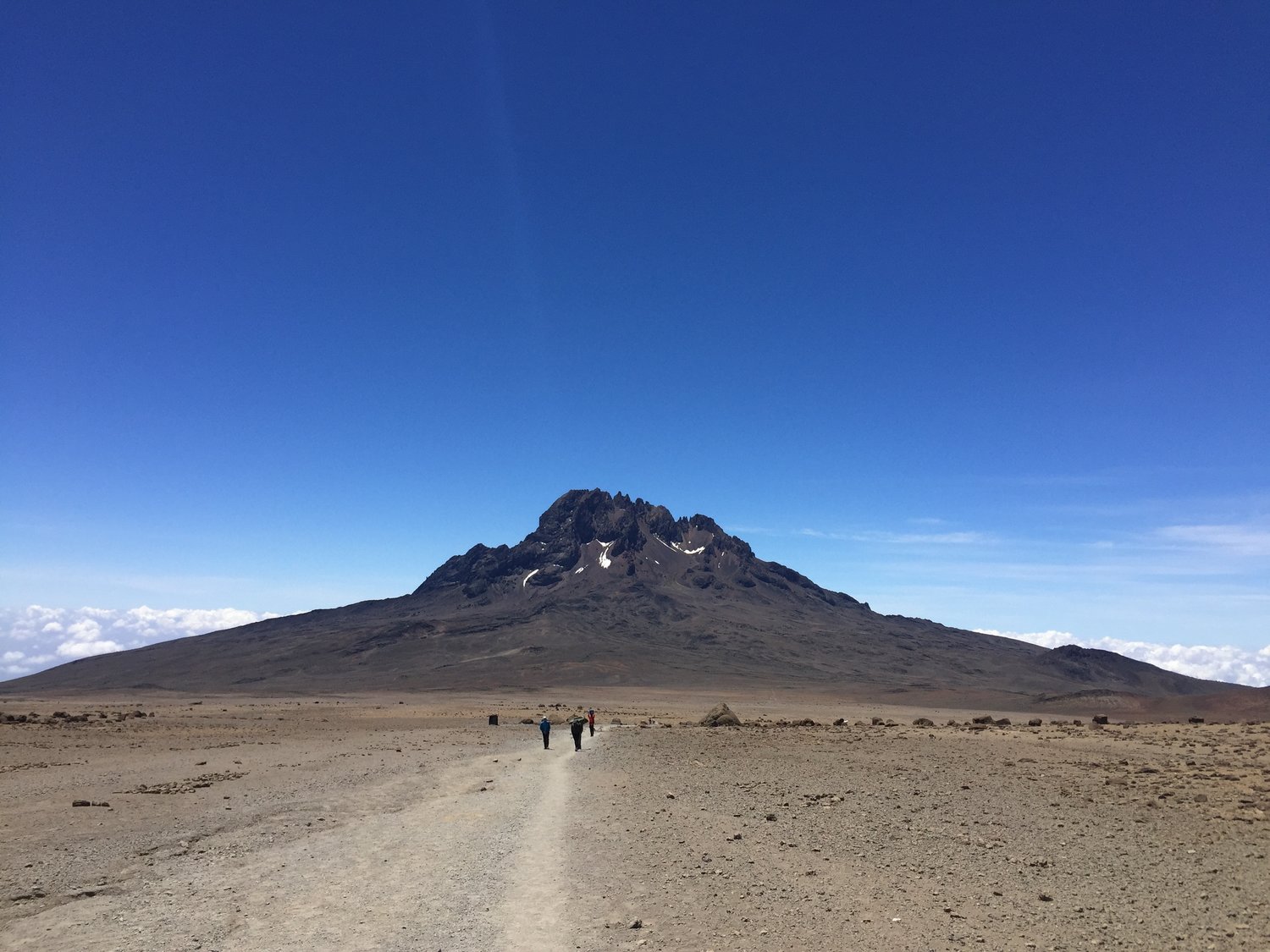
Today will continue through the east up ridge and then southeast towards Lava Tower
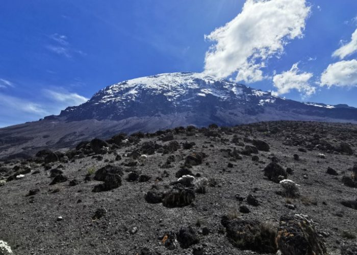
Volcanic rock formation 300 ft taller. We will go down to Barranco Camp through the weird beautiful Senecio Forest to an altitude of 13,000 ft. Although you end the day at same elevation. Lava Tower has a higher altitude and it is very beneficial for acclimatization.
Day 4: Barranco Camp to Karanga Camp
Elevation: 13,044 ft to 13,106 ft
Distance: 5 km | 3 miles
Hiking Time: 4-5 hours Habitat: Alpine Desert
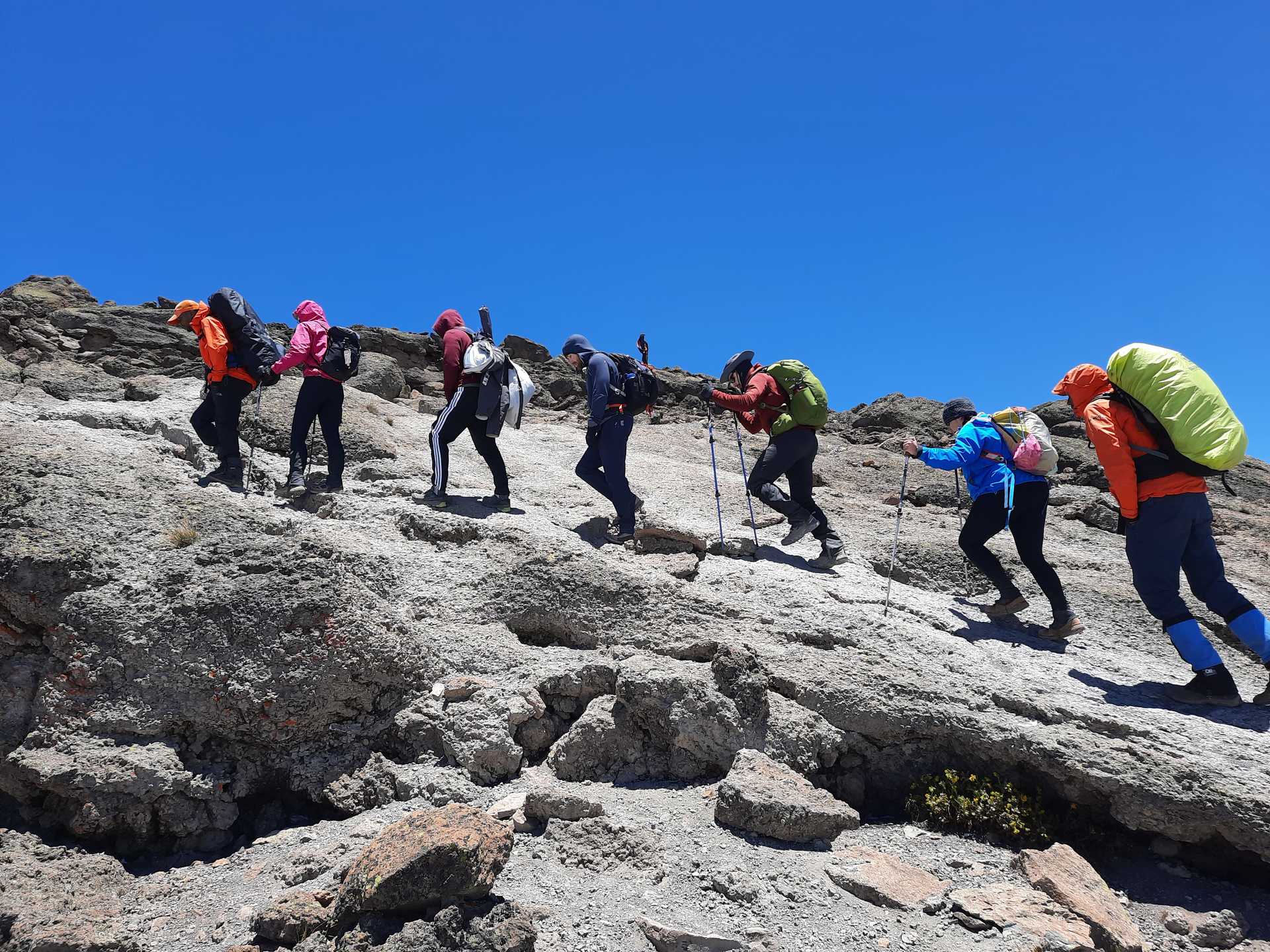
Today we will start the day by descending through a ravine to the base of the Great Barranco Wall. Non-technical climbing but sharp, approximately 900 ft cliff. Once we reach the top of Barranco Wall we will go through a series of hills and valleys, until descent sharply toward Karanga Valley. We will be near by the camp after one steeper climb up to be in the lead of Karanga Camp.
Day 5: Karanga Camp to Barafu Camp
Elevation: 13,106 ft to 15,331 ft
Distance: 4 km | 2 miles
Hiking Time: 4-5 hours
Habitat: Alpine Desert
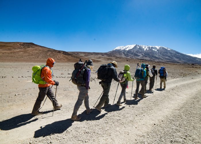
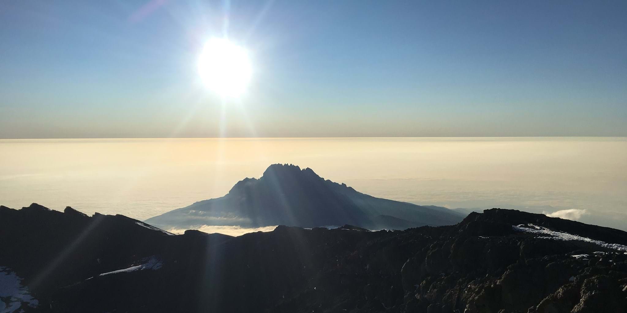
After a cup of coffee, you will leave Karanga and through the junction which links the Mweka Trail then we will proceed up to the rocky section to Barafu Hut. Once you complete the southern Circuit you will see a lovely summit views from many different angles. We will rest at the camp and enjoy then having dinner to prepare for summit day. The View of the peaks of Mawezi and Kibo can be found from the position of Barafu camp.
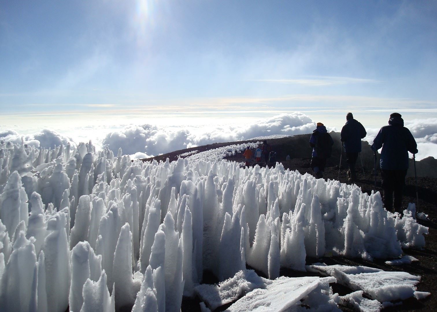
Day 6: Barafu Camp to Uhuru Peak
Elevation: 15,331 ft to 19,341 ft Distance: 5 km | 3 miles
Hiking Time: 7-8 hours Habitat: Arctic
Uhuru Peak to Mweka Camp
Elevation: 19,341 ft to 10,065 ft
Distance: 12 km | 7 miles
Hiking Time: 4-6 hours
Habitat: Rain Forest
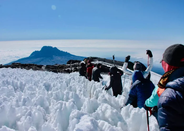
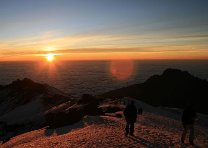
Around midnight we will start walking to the summit. Today will be the most of mentally and physically challenging day of the trek. The weather can be wind and cold at this elevation and time day can be radical. We climb in darkness for several hours and friendly break near Stella Point – 18900 ft upon there you see a marvellous sunrise coming from Mawezi Peak. Finally, we reach the top at Uhuru Peak- Kilimanjaro the highest point and continent of Africa.
After the summit, we will descent straight to the Mweka Hut camp site then stopping at Barafu for lunch. The trails will be quite hard and very rocky. Mweka Camp is located through the upper forest and fog or rain in the late afternoon can be expected. Today will be your last day to enjoy your dinner on the Mountain and good day to sleep.
Day 7: Mweka Camp to Mweka Gate
Elevation: 10,065 ft to 5,380 ft Distance: 10 km | 6 miles
Hiking Time: 3-4 hours
Habitat: Rain Forest
Today is the last day, after breakfast will start the descent to Mweka Gate and get your summit certificates. It might be wet and muddy due to lower elevations. Once you step out of the gate you will continue to Mweka Village roughly 1 hour, the vehicle will be waiting for you then drive you back to the hotel in Moshi.